 |
|||||||||||||
|
|||||||||||||
|
|
|
|
|||||||||||
|
Visiting
the Araucaria property
See
below for ideas for incorporating a visit to the
Scenic Rim Wild
 South-east Queensland and northern New
South Wales
together
constitute
one of the most
scenic and
species-rich
regions of
Australia, and
one that is
readily
accessible from
Queensland's
capital, Brisbane.
There
are
so many options
for self-drive
tours to
interesting and
beautiful
places
that you could
easily spend
many months
exploring them
all.
Accommodation
ranges from
primitive
camping through
caravan parks,
hostels, guests
houses,
eco-lodges, farm
stays, motels
and budget
hotels to
five-star
hotels and
resorts. South-east Queensland and northern New
South Wales
together
constitute
one of the most
scenic and
species-rich
regions of
Australia, and
one that is
readily
accessible from
Queensland's
capital, Brisbane.
There
are
so many options
for self-drive
tours to
interesting and
beautiful
places
that you could
easily spend
many months
exploring them
all.
Accommodation
ranges from
primitive
camping through
caravan parks,
hostels, guests
houses,
eco-lodges, farm
stays, motels
and budget
hotels to
five-star
hotels and
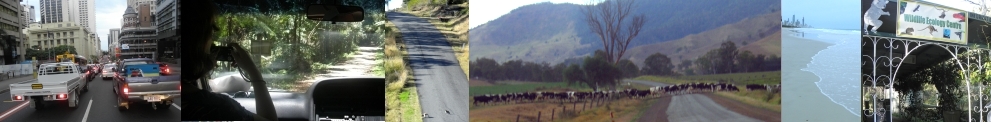
resorts.Scenic Rim - this is a region formed by three ancient and giant shield volcanoes to the west and south of what is now Brisbane and the valleys associated with them Rainforest Way - a network of roads linking rainforest experiences in south-eastern Queensland and north-eastern New South Wales 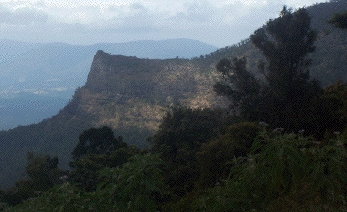 Australia's
Green Cauldron
- the
area surrounding
and including
the long-extinct
Tweed volcano
(one of
the three
mentioned above,
which now
retains one of
the world's
best-preserved
calderas Australia's
Green Cauldron
- the
area surrounding
and including
the long-extinct
Tweed volcano
(one of
the three
mentioned above,
which now
retains one of
the world's
best-preserved
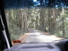
calderasCountry Charm - an upmarket tour with much of the preliminary organizing done for you Longer drives - from north Queensland, Sydney or Adelaide - we can offer advice on interesting routes There are several useful books to help you choose a route and learn about the natural history and culture of the region: e.g. Wild Guide to the Scenic Rim (available from Information Centres throughout the Scenic Rim), Take a Walk (J and L Daly), Natural History of Lamington National Park (ed. Lesley Hutley). Visiting the Araucaria propertyOur Scenic Rim Wildlife Ecology Centre and associated nature trails are available with prior booking for self-drives, campers at the adjacent Andrew Drynan Reserve or anyone living in or visiting our region. Let us know if you would like us to arrange some activities (the longer the advance notice the better able we will be to prepare something according to you or your group's interests). We are positioned on one of the loops of the Rainforest Way See Google map of property Possibilities for scenic drives including the Scenic Rim Wildlife Ecology Centre: |
|||||||||||||
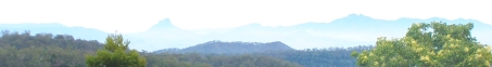
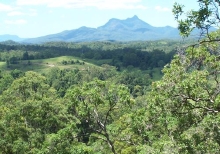
Scenic Rim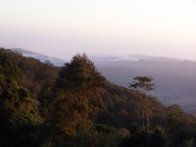 Geographically,
the
Scenic
Rim generally
refers to the
mountains
south and west
of Brisbane
formed by
three ancient
and gigantic
shield
volcanoes.
It is
sometimes
extended to
include
mountainous
country just
south of the
New
South Wales
border, which
is after all
part of the
same
geological
series of
events, just
an artificial
political
boundary
separating
them.
Politically,
the Scenic Rim
Regional
Council
includes the
southern half
of this
region, from
Binna Burra to
Tamborine
Mountain and
west almost
to the Great
Dividing Range
(west of
Boonah), with
the New South
Wales
border as its
boundary. Geographically,
the
Scenic
Rim generally
refers to the
mountains
south and west
of Brisbane
formed by
three ancient
and gigantic
shield
volcanoes.
It is
sometimes
extended to
include
mountainous
country just
south of the
New
South Wales
border, which
is after all
part of the
same
geological
series of
events, just
an artificial
political
boundary
separating
them.
Politically,
the Scenic Rim
Regional
Council
includes the
southern half
of this
region, from
Binna Burra to
Tamborine
Mountain and
west almost
to the Great
Dividing Range
(west of
Boonah), with
the New South
Wales
border as its
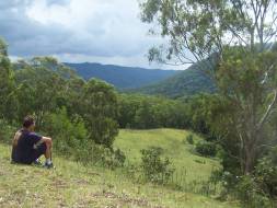
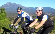
boundary.There are many wonderful opportunities for self-drives, for just a day from Brisbane or the Gold Coast or sites within the Scenic Rim itself, or for a weekend or better still, several days. Accommodation includes campgrounds with and without facilities, caravan parks, guests houses, romantic cabins, family cabins, eco-lodges by networks of rainforest walking tracks or rugged mountains to climb, farm stays, motels, hotels for all budgets and upmarket resorts. You can use this interactive map to find out how to reach the region from wherever your starting point might be. For advice on self-drives and chartered outings ( families, individuals, school groups, tertiary groups, scouts and guides, researchers, conference delegates, birders, nature photographers, artists...) that include the Scenic Rim Wildlife Ecology Centre on Lions Road, contact Araucaria Ecotours for suggested itineraries to maximize your experience of the wildlife, forests, mountains and other natural wonders of this region. Closest accommodation to the Wildlife Ecology Centre is camping at Andrew Drynan Reserve (adjacent), the motel at Rathdowney (17km) or a very beautiful bed-and-breakfast at Cougal Park (14km). See also Visit Scenic Rim (Scenic Rim Regional Council: southern end of the Scenic Rim), Scenic Rim Escapes (tourism attractions and accommodation mostly in the eastern part of Scenic Rim shire). Scenic Rim Tourism (tourism attractions and accommodation mostly in western part of Scenic Rim Regional Council), and country drives from Toowoomba (northwestern section of the Scenic Rim, not within in the SRRC) |
|||||||||||||
|
|||||||||||||
 (suitable
also
for
energetic
cyclists:
(suitable
also
for
energetic
cyclists: 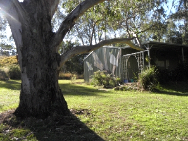
 Visit the Centre for an hour or
so during a
Visit the Centre for an hour or
so during a 
 Country
Charm
Country
Charm